Share the post "Which Texas Cities Have the Best Weather?"
Are you wondering which Texas cities have the best weather? You might think you know the answer if you’ve lived in Texas for any time. You might still consider you have the answer if you’ve never visited Texas.
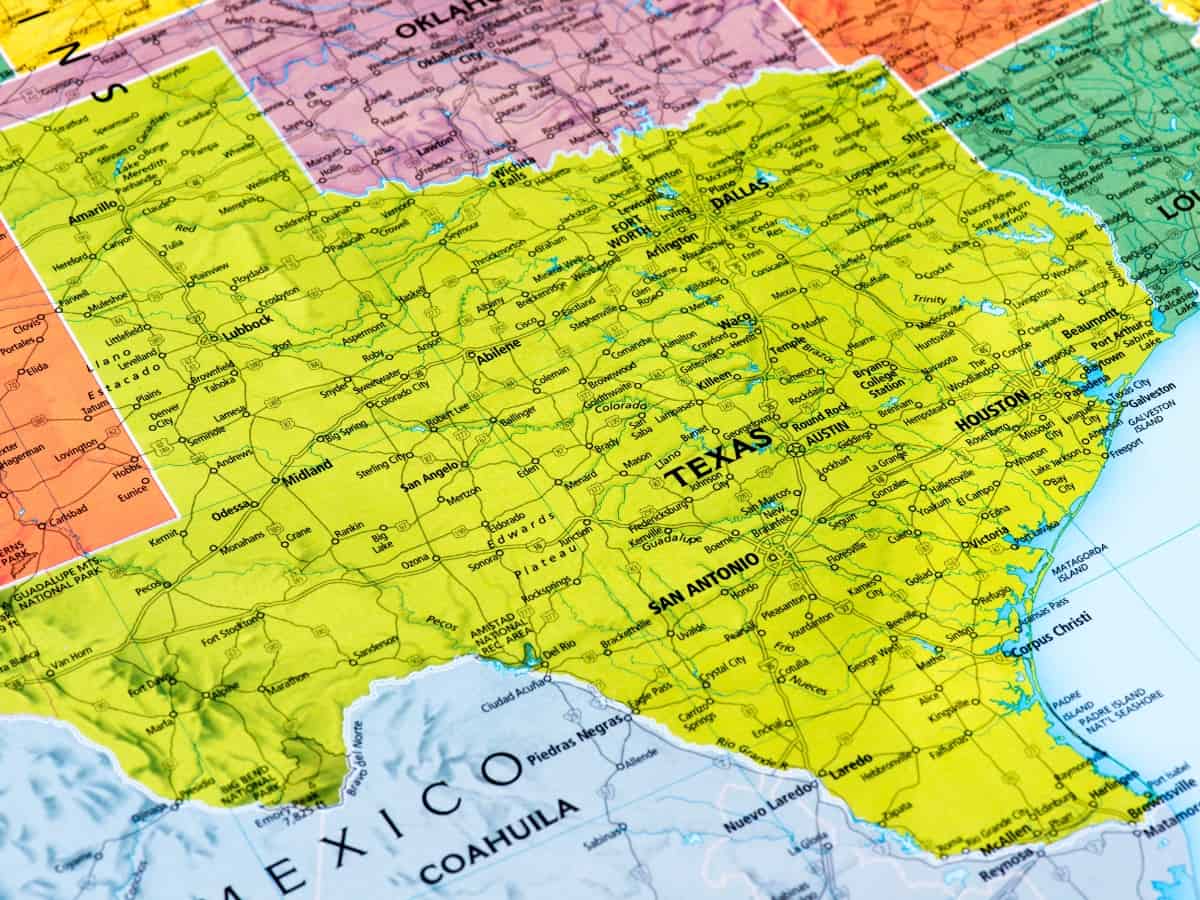
Texas has a reputation for being hot, dry, and sunny most of the time. The truth is, there’s a lot more to Texas weather than initially meets the eye. Even though it is hot and dry, there are also remarkably temperate parts.
Texas is a state filled with variety, especially in the environment. However, Texas gets very hot and is often quite arid; some parts of the state experience rain, cool weather, and even snow in the winter.
Key Points:
- Houston has the best weather among the major Texas cities, but Fredericksburg and Odessa also have favorable climates.
- Texas has a diverse climate, ranging from hot and dry in the west to humid and subtropical in the east.
- Factors like elevation, proximity to water, and urban development can impact weather conditions in different cities.
- Considerations for gardening include temperature, rainfall, soil quality, growing season, and potential for extreme weather events.
- Each region of Texas has its pros and cons regarding weather, so the best area depends on personal preferences.
Which Texas Cities Have the Best Weather?
There are six major cities in Texas. According to historical and meteorological data, Houston has the best weather of the six major cities:
- Houston
- San Antonio
- Dallas
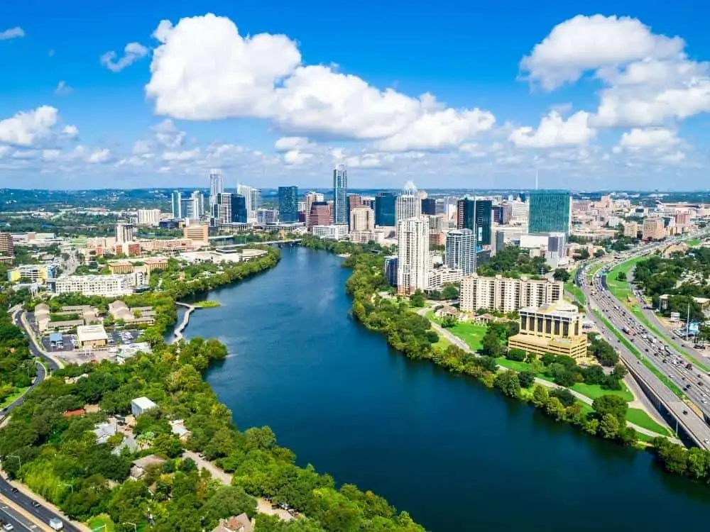
- Austin
- Forth Worth
- El Paso
However, other cities like Fredericksburg and Odessa also have excellent weather for different reasons.
Texas has a diverse climate that can vary depending on where you are in the state. The west part of Texas can get hot and dry, while the east can be humid and subtropical. Since the state is so large, it’s easy for various weather patterns to develop.
The northern panhandle of Texas can reach temperatures 10 degrees cooler than the rest of the state. Meanwhile, the southern coastal regions of the state are hot and rainy.
Severe weather can also plague Texas. Texas could see everything from hurricanes to tornadoes to thunderstorms. Lots of rain comes in the early spring, and the winters can see terrible ice storms.
The varied nature of the Texas climate means that visitors can have a world of experiences visiting one state. But if you want to find which Texas cities have the best weather, check out these beautiful spots:
- Houston
- Fredericksburg
- Odessa
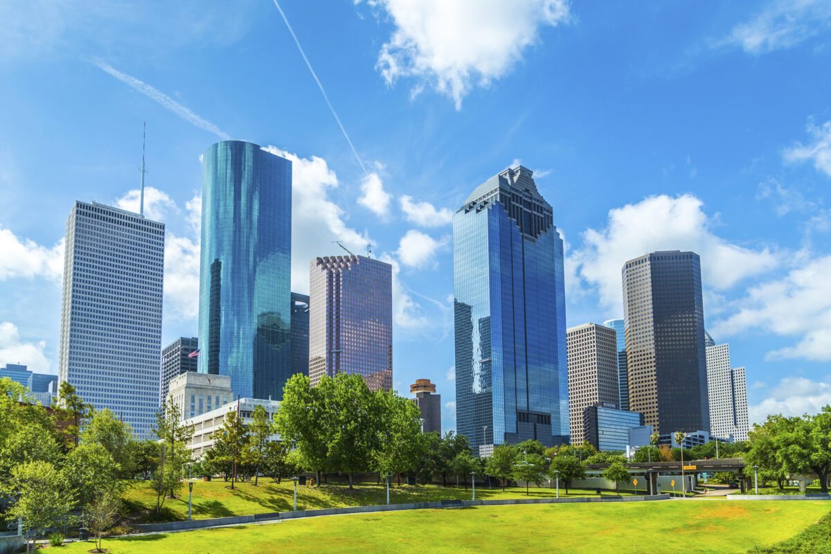
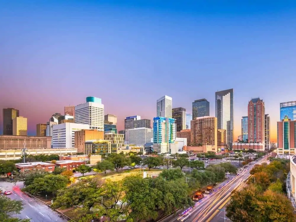
Houston
Houston is the largest city in Texas, with just over two million residents. Located in southeast Texas, Houston is the fourth-largest city in the whole United States of America.
Weather
The worst part of Houston’s weather is the summer. They can be long, hot, and abrasive. There isn’t much relief in the summer, and temperatures regularly get above 100 degrees.
However, part of the year sees more rainfall and cloud cover. The change usually provides enough respite for residents to remember why they love the place.
In the winter, Houston doesn’t get as much precipitation as other parts of the state. It stays relatively dry, although snow and ice might come. But it stays cool and temperate throughout the winter.
Fredericksburg
Situated in the heart of Texas Hill Country, Fredericksburg is a charming tourist town of German heritage. The city offers plenty of attractions and quirky destinations for visitors from all over the world.
Weather
Fredericksburg might register more typically like a Texas town. The summers are hot and humid, the winters are short and cold, and the temperature rarely falls below 24 degrees.
However, even in the summer, the temperatures rarely get above 100 degrees. Compared to other parts of Texas, that’s quite an accomplishment.
One of the best things about Fredericksburg is its low risk for tornadoes. Because it sits in the Hill Country, it’s much less common for tornadoes to strike.

Odessa
Located in West Texas, Odessa sits right in the middle of the Permian Basin. With nearly 100,000 residents, Odessa is the halfway point between Fort Worth and El Paso.
Weather
The weather in Odessa is one of the main attractions. The summers can run a little long and hot, but they’re usually bearable compared to the rest of the state.
In the winter, you might see cold temps and snow. It gets windy in West Texas, and Odessa is no exception. But it stays pretty dry and doesn’t last too long.
The risk of tornadoes is lower in Odessa than the average for the state, making it one of the safer areas to live in Texas.

Annual Temperature Averages
Compare the annual high and low-temperature averages for Austin, Houston, Dallas, San Antonio, and El Paso. Do note that these figures are approximate, based on historical averages, and actual temperatures can vary from year to year.
- Austin:
- Average High: Around 79°F (26°C)
- Average Low: Around 59°F (15°C)
- Houston:
- Average High: Around 78°F (26°C)
- Average Low: Around 60°F (16°C)
- Dallas:
- Average High: Around 77°F (25°C)
- Average Low: Around 57°F (14°C)
- San Antonio:
- Average High: Around 80°F (27°C)
- Average Low: Around 60°F (16°C)
- El Paso:
- Average High: Around 78°F (26°C)
- Average Low: Around 54°F (12°C)
Some points to consider:
- Coastal Influence: Houston, being closer to the Gulf of Mexico, tends to have higher humidity, which can make the temperatures feel warmer than they are.
- Elevation: El Paso is at a much higher elevation than the other cities, which can lead to cooler nights.
- Latitude: Dallas, being further north, can have colder winter temperatures compared to San Antonio or Houston.
- Urban Heat Island Effect: Larger cities with more concrete and fewer green spaces can be hotter than surrounding areas due to the urban heat island effect.
Number of sunny days in Texas cities
The exact number can vary between cities due to geographical, atmospheric, and seasonal factors. Here’s an approximate comparison of annual sunny days for some of the main Texas cities:
- El Paso: Around 300-320 sunny days per year. It’s one of the sunniest cities in Texas, situated in the western part of the state in a desert environment.
- Lubbock: Approximately 260-280 sunny days annually. Lubbock, being in the South Plains region, also enjoys a lot of sunshine, especially during summer.
- Austin: Around 230-250 sunny days per year. Central Texas has a good balance of sun and rain, but it still enjoys a fair amount of sunny weather.
- San Antonio: Approximately 220-240 sunny days annually. Being south but not too coastal, San Antonio’s climate resembles Austin’s.
- Dallas: Around 230-250 sunny days per year. The DFW area experiences varied weather, but it has many sunny days with occasional storms.
- Houston: Approximately 204-225 sunny days per year. Houston’s proximity to the Gulf of Mexico means it gets more rainfall and cloudy weather than some other Texas cities, especially during hurricane season.
- Corpus Christi: Around 220-235 sunny days annually. As a coastal city, it sees a balance between sunny days and periods of higher humidity and cloud cover.
- Fort Worth: Approximately 230-250 sunny days annually. Similar to Dallas, given its proximity, but the two cities might have slight variations.
- Amarillo: Around 260-275 sunny days per year. Located in the Texas Panhandle, Amarillo experiences colder winters but maintains a good amount of sunshine throughout the year.
- Brownsville: Approximately 230-245 sunny days annually. Located at the southernmost tip of Texas, Brownsville has a mix of sunny days and humid, cloudy conditions due to its proximity to the Gulf.
Remember, these figures are approximate and can vary based on specific data sources and the criteria for defining a “sunny day.” Some sources might consider a day with morning cloud cover that clears up by afternoon as sunny, while others might be stricter. If you need more precise or updated information, a meteorological service or a specific weather database for Texas would be ideal.
Elevation’s Impact on Climate in Texas
Elevation plays a critical role in determining the climate of a region, and Texas, given its vast size and diverse topography, provides a fascinating study in this regard. The state ranges from sea level along the Gulf Coast to over 8,000 feet in the Guadalupe Mountains. Here’s how elevation impacts the climate in Texas:
- Temperature: As a general rule, for every 1,000-foot increase in elevation, there’s a drop of about 3.5°F to 5°F in temperature. Thus, areas of West Texas, like the Guadalupe Mountains or the Davis Mountains, which have higher elevations, tend to have cooler temperatures than the rest of the state, especially during nighttime.
- Air Density: Higher elevations have thinner air. This not only affects temperature but can also result in decreased oxygen levels, which might be noticeable to some visitors.
- Precipitation Patterns: Elevation can influence precipitation patterns. Mountainous regions can force moist air to rise, cool, and condense, leading to rainfall on the windward side (orographic precipitation). The leeward side (downwind side) of the mountain might receive much less moisture, creating a rain shadow effect.
- Humidity: Generally, higher elevations tend to have lower humidity levels. This is evident in places like El Paso or Alpine, where the air is drier than the humid coastal plains of Houston or Corpus Christi.
- Snowfall: Higher elevations in Texas, particularly in the Panhandle and the mountainous regions of West Texas, see more frequent and significant snowfall than lower-lying areas.
- Diurnal Temperature Range: Areas with higher elevations often experience a more considerable difference between daytime highs and nighttime lows. This diurnal temperature range is more pronounced in desert or semi-arid regions of West Texas.
- Plant and Animal Life: The elevation impacts the types of vegetation and wildlife in an area, which in turn can influence local microclimates. For instance, higher elevation areas might support pine forests, which can affect local humidity and temperature.
- Air Quality: Higher elevations often have cleaner air, as many pollutants tend to accumulate at lower elevations. However, specific geographical features, like valleys, can trap air and reduce air quality.
In Texas, the contrast between the High Plains of the Panhandle, the Hill Country around Austin and San Antonio, the Trans-Pecos region’s mountainous areas, and the coastal plains provides a diverse climatic range driven partly by differences in elevation.
This diversity makes Texas home to multiple climate zones, from humid subtropical in the east to semi-arid in the west.

Cities with the best weather for gardening in Texas
When considering the best cities in Texas for gardening, several factors include temperature, rainfall, soil quality, length of growing season, and potential for extreme weather events (e.g., hail, freezes, or excessive heat). Here are some cities in Texas that offer favorable conditions for gardening, along with a brief explanation for each:
- San Antonio:
- Climate: San Antonio has a humid subtropical climate. It has hot summers, but its winters are relatively mild.
- Advantage: A long growing season and a wide variety of plants can be cultivated year-round.
- Drawback: Occasional frosts in winter and periods of drought.
- Austin:
- Climate: Like San Antonio, Austin has a humid subtropical climate with hot summers and mild winters.
- Advantage: A diverse range of plants can be grown, from vegetables to ornamental flowers. The city also has a vibrant gardening community.
- Drawback: Occasional winter frosts and susceptibility to both drought and flooding.
- Houston:
- Climate: Houston’s proximity to the Gulf of Mexico gives it a more humid climate, with more rainfall than San Antonio or Austin.
- Advantage: The city’s high humidity and rainfall can benefit many tropical plants.
- Drawback: High humidity can also lead to plant diseases. Houston is also prone to hurricanes.
- Dallas/Fort Worth:
- Climate: While still classified as humid subtropical, the DFW area can experience colder winters than cities further south.
- Advantage: Slightly cooler temperatures can benefit certain crops, especially in the spring and fall.
- Drawback: Risk of late spring frosts, occasional hailstorms, and hot, dry summer spells.
- El Paso:
- Climate: El Paso has a desert climate, with hot summers and cool winters.
- Advantage: Ideal for drought-tolerant plants, succulents, and certain vegetables that thrive in drier conditions.
- Drawback: Limited rainfall and occasionally freezing winter temperatures.
- Lubbock:
- Climate: A semi-arid climate with cold winters and hot summers.
- Advantage: Well-suited for drought-resistant plants and crops.
- Drawback: Occasional severe weather, including hailstorms and late or early frosts.
- Corpus Christi:
- Climate: Humid subtropical with influence from the Gulf, leading to milder winters.
- Advantage: Suitable for tropical plants and has a longer growing season.
- Drawback: The risk of hurricanes and salt spray might be unsuitable for certain plants.
When choosing a city for gardening in Texas, the specific types of plants you intend to cultivate play a crucial role. While one city might be perfect for tropical plants, another might be better suited for drought-tolerant varieties or traditional vegetable gardens.
It’s also essential to consider microclimates within cities, as local conditions can vary significantly based on elevation, proximity to water, and urban development.
Pros and Cons of Weather in Each Region (Where to live)
Coastal Plains (Including Houston and Corpus Christi)
- Pros: Mild winters, proximity to the Gulf for breezes.
- Cons: Hot and humid summers, hurricane risk.
South Texas (Including San Antonio and Laredo)
- Pros: Mild winters, sunny most of the year.
- Cons: Extremely hot summers, high humidity.
Central Texas (Including Austin and Waco)
- Pros: Mild winters and moderate humidity.
- Cons: Hot summers, but less humid than coastal areas.
North Texas (Including Dallas-Fort Worth)
- Pros: Diverse seasons, with mild to moderate winters.
- Cons: Hot summers, prone to thunderstorms and tornadoes.
East Texas (Including Tyler and Longview)
- Pros: Lush, green landscape, mild winters.
- Cons: High humidity, prone to thunderstorms.
West Texas (Including El Paso and Lubbock)
- Pros: Low humidity, cooler evenings.
- Cons: Hot summers, cold winters, and windy conditions.
Texas Hill Country (Including Fredericksburg and Kerrville)
- Pros: Beautiful scenery, milder summers compared to other regions.
- Cons: Risk of flash floods, especially in spring and fall.
Texas Panhandle (Including Amarillo)
- Pros: Cooler temperatures in summer compared to rest of Texas.
- Cons: Cold winters, susceptible to snow and tornadoes.
Your preference for “best weather” might depend on your tolerance for heat, humidity, and other climatic conditions. Each region has its advantages and disadvantages, so the best area for you will depend on your specific needs and what you consider favorable weather.
Texas Weather FAQ
Now we know more about the cities in Texas with the best weather. Let’s look at some of the most common questions when considering which Texas cities have the best weather.
Which part of Texas has the best winters?
Although many cities in Texas experience snow, ice, and wind through the winter months, quite a few experience almost no winter.
In Austin, the average temperature is at least 11 degrees warmer than in the rest of the state. Even in the winter, the climate stays a little bit warmer.
But if you want to beat the heat and look for more snow during the winter, then Fort Worth has the best record. It gets more snow than most other regions of Texas because it sits at a higher elevation.
Generally, the northern panhandle sees the most winter weather. However, the extreme south of the southern panhandle can see temps below zero.

Which city in Texas gets the least rain?
Texas is known for being a big, hot, dry state. There are parts of the state where this is undoubtedly true. The western tip of the state is particularly arid.
El Paso sits right on the border of Texas and Mexico, in the far southwestern part of the state. If they even get that much, the city rarely has more than five days of rain a month. In the summer, it might rain for a total of eight days.
The lowest annual precipitation numbers recorded were just under eight inches in El Paso.
Which cities in Texas experience fewer natural disasters?
A few cities seem less prone to truly horrific weather. A few of those Texas cities include:
- Amarillo
- Huntsville
- Laredo
- El Paso
Although these cities are less prone to bad weather like tornadoes, every Texan knows that disaster can strike anywhere unexpectedly.
Share the post "Which Texas Cities Have the Best Weather?"

Christian Linden is a seasoned writer and contributor at Texas View, specializing in topics that resonate with the Texan community. With over a decade of experience in journalism, Christian brings a wealth of knowledge in local politics, culture, and lifestyle. He holds a Bachelor's degree in Communications from the University of Texas. When he's not writing, Christian enjoys spending weekends traveling across Texas with his family, exploring everything from bustling cities to serene landscapes.